Sign in to access WMTS endpoints.
Sign in to download GeoTIFF.
Sign in to export as IIIF.
Compare
Website
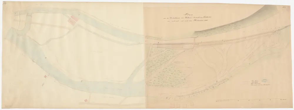
Enge, Aussersihl, Wiedikon: Sihl vom Wehr bis zum Sihlhölzli; Situationsplan (Sihl-Gebiet Nr. 4)
PLAN_L_1536
Maps
Verhältnisse vor, während und nach dem Hochwasser von 1846. Mit Legende.
From 1850-02-01 to 1850-02-28
163.5 × 58 cm
1 : 500
250