![旧地图预览](https://thumbs.oldmapsonline.org/4d/758d0d69f65e45b38a9368fa98ffcd89.thumbnail-1000.webp)
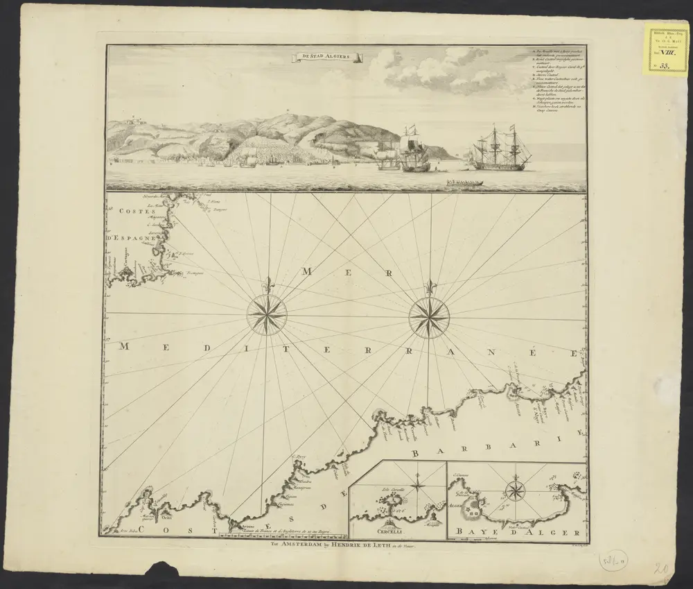
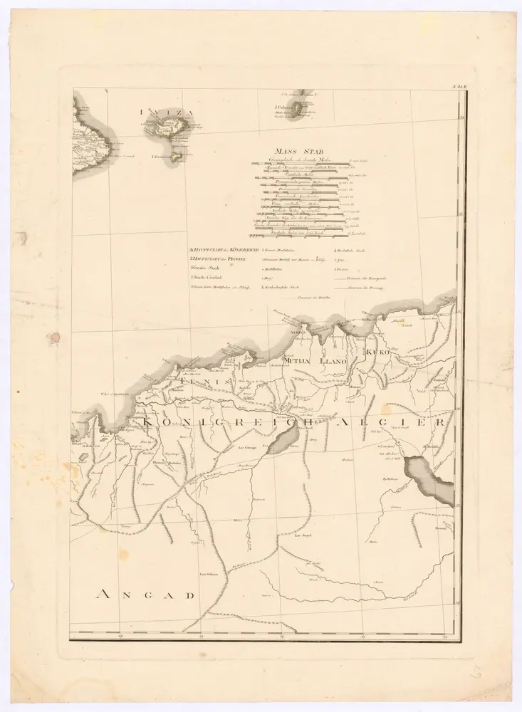
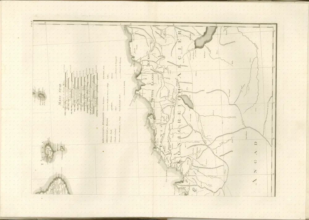
[The coast of Algeria]
1760
H. de Leth fecit.
1:1m
![旧地图预览](https://thumbs.oldmapsonline.org/5f/bb00e20fc8314eb3a1126bccce0b43dd.thumbnail-1000.webp)
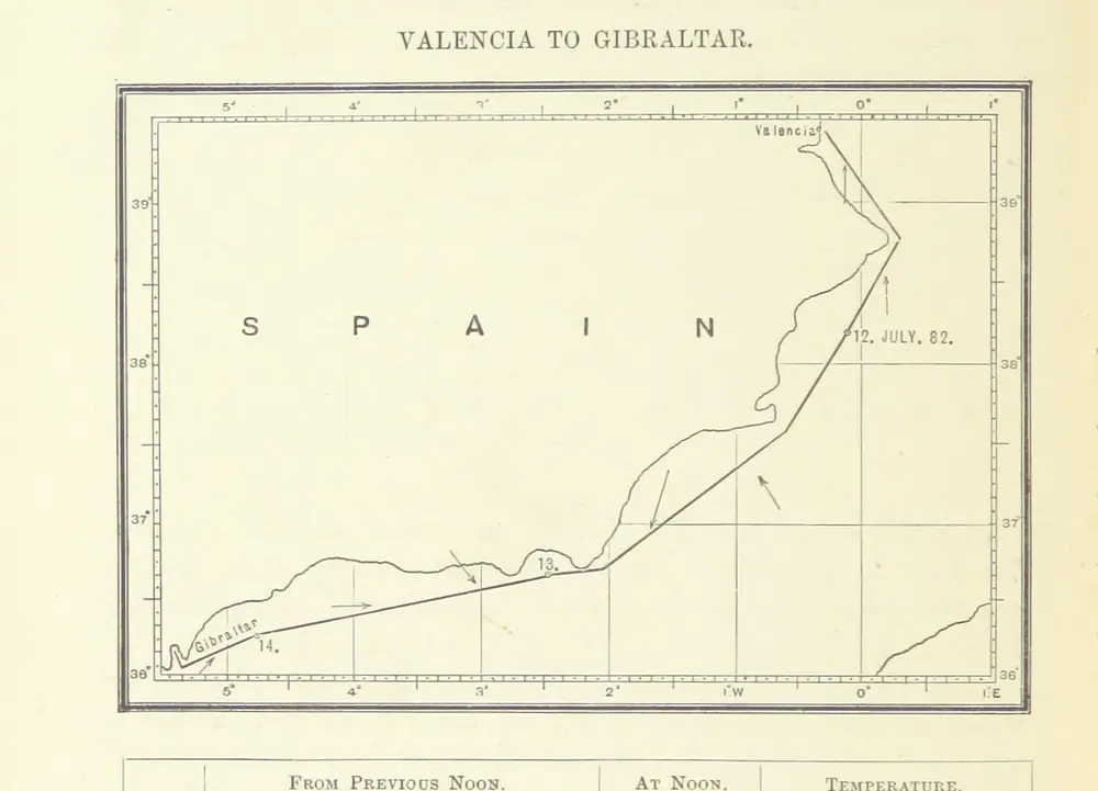
The Cruise of Her Majesty's Ship “Bacchante,” 1879-1882. Compiled from the private journals, letters and note-books of Prince Albert Victor and Prince George of Wales, with additions by J. N. Dalton
1886
DALTON, John Neale.
![旧地图预览](https://thumbs.oldmapsonline.org/48/78ada176dce24aeca59dc3ec2961bfae.thumbnail-1000.webp)
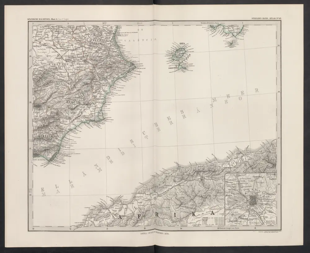
[Spanien und Portugal in 4 Blättern, Blatt 4]
1876
Stieler, Adolf
![旧地图预览](https://thumbs.oldmapsonline.org/22/e09878994b084b0ca9ba91275174af05.thumbnail-1000.webp)
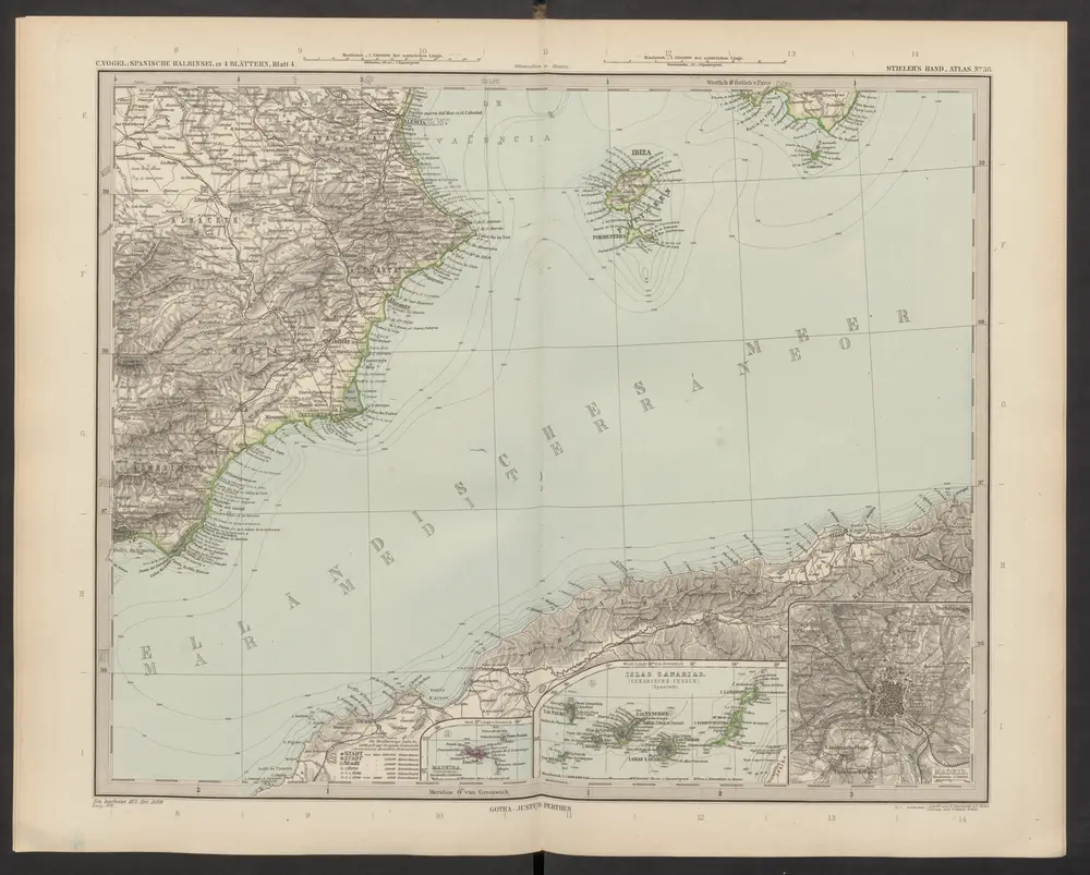
[Spanien und Portugal, Blatt 4]
1892
Stieler, Adolf
![旧地图预览](https://thumbs.oldmapsonline.org/55/649edfa1fb9f4408ba73cf0420274849.thumbnail-1000.webp)
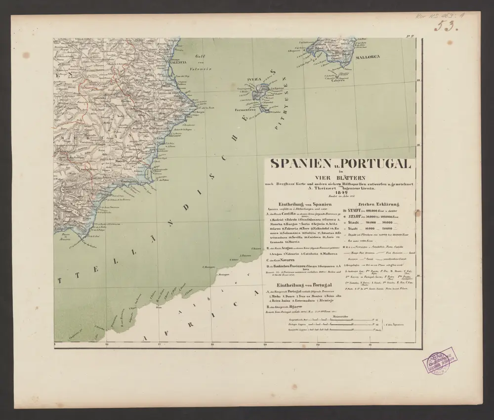
Spanien u. Portugal in vier Blättern : nach Berghaus' Karte und andern sichern Hülfsquellen
1842
[Gotha] : [J. Perthes]
![旧地图预览](https://thumbs.oldmapsonline.org/c6/42aae7d131e245c6862f9efeb06f4c9c.thumbnail-1000.webp)
Neueste Generalkarte von Portugal und Spanien
1790
Schraembl, Franz Anton
![旧地图预览](https://thumbs.oldmapsonline.org/36/d700fe1949e246e78df2e6cc036b09e5.thumbnail-1000.webp)
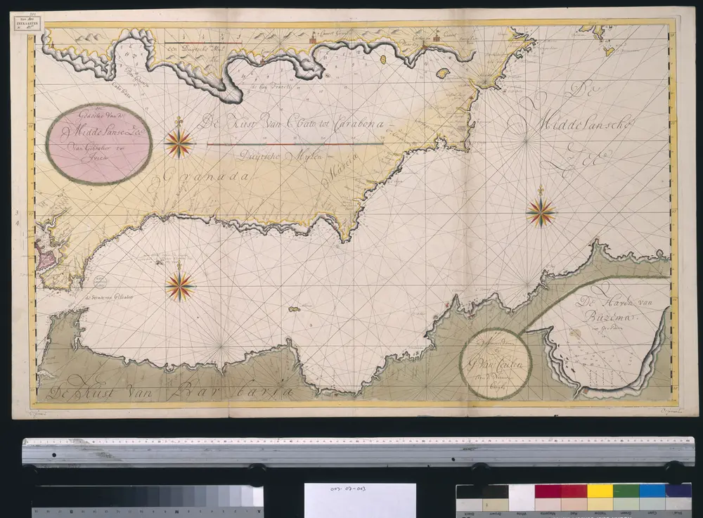
Een gedeelte van de Middelanse Zee van Gibraltar tot Ivica
1720
Gerard van Keulen
![旧地图预览](https://thumbs.oldmapsonline.org/e4/9d4bd53d1e8e4dcba286eb465124d154.thumbnail-1000.webp)
mapa z atlasu "Allgemeiner Grosser Schrämblischer Atlass"
1800
Schraembl, Franz Anton
![旧地图预览](https://thumbs.oldmapsonline.org/c9/85653f46ad8244f79b7b86d065b59243.thumbnail-1000.webp)
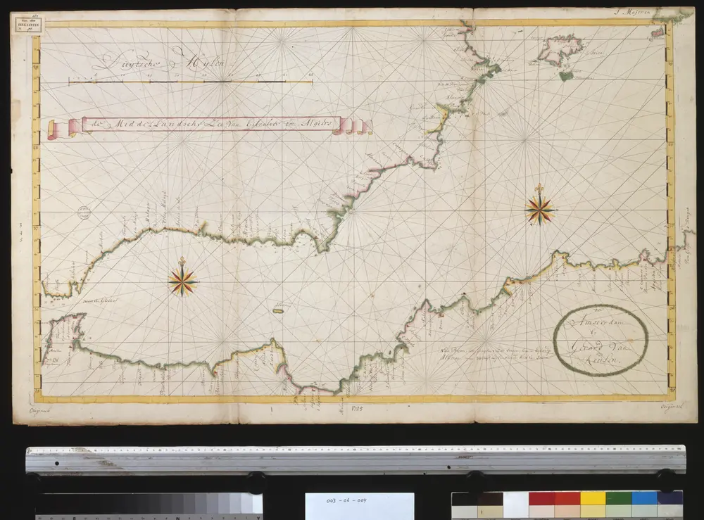
De Middellandsche Zee van Gibralter tot Algiers
1725
Gerard van Keulen
![旧地图预览](https://thumbs.oldmapsonline.org/9f/c90f944ffed34826aef96edcf5477e16.thumbnail-1000.webp)
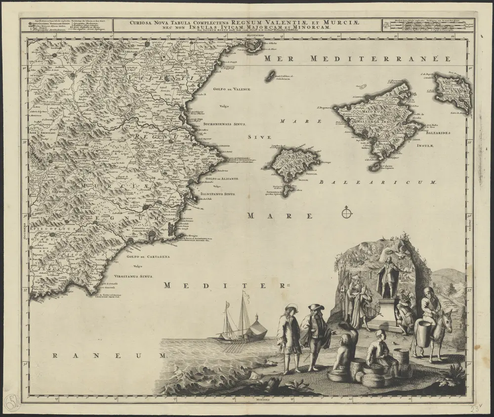
Curiosa nova tabula complectens regnum Valentiae et Murciae nec non Insulas Ivicam, Majorcam et Minorcam
1695
per Jacobum Robyn
1:1m